Zambia is one of Africa’s most stable and investment-friendly nations, strategically located at the heart of the continent. Sharing borders with Angola, the Democratic Republic of Congo (DRC), Tanzania, Malawi, Mozambique, Zimbabwe, Botswana and Namibia, the country serves as a vital gateway for regional trade, mining and industrial development.
Renowned for its rich geological endowment, Zambia hosts some of the world’s largest copper and cobalt deposits within the Lufilian Arc, a globally significant mineral belt that stretches through north-western Zambia into the DRC. In addition to copper and cobalt, the country possesses substantial reserves of gold, nickel, uranium, manganese, iron ore, lead, zinc and several emerging critical minerals essential for the global energy transition.
The Zambian Government continues to strengthen the country’s investment climate through economic reforms, transparent mining policies and initiatives aimed at attracting both local and international investors. These efforts, combined with ongoing geological surveys and exploration programmes, are unlocking new opportunities across the country’s vast mineral-rich regions.
Climate and Geography
Situated within the tropical zone at an average elevation of 1,000 to 1,500 metres above sea level, Zambia enjoys a favourable climate that supports year-round mining, agriculture and infrastructure development. The country experiences three distinct seasons:
- Cool Dry Season (May–August): Average daytime temperatures range between 15°C and 27°C.
- Hot Dry Season (September–November): Temperatures typically range from 27°C to 32°C.
- Warm Wet Season (December–April): Temperatures average between 20°C and 27°C, accompanied by seasonal rainfall that supports agriculture and replenishes the country’s water resources.
Population and Major Economic Centres
Covering approximately 752,614 square kilometres, Zambia is one of Africa’s largest countries by land area. Its relatively low population density provides significant opportunities for industrial expansion, agriculture and mineral exploration.
The capital city, Lusaka, is the country’s commercial and administrative centre. Other key economic and mining hubs include Kitwe, Ndola, Chingola, Mufulira, Luanshya, Kalulushi, Solwezi, Kabwe, Kapiri Mposhi and Livingstone.
Water Resources and Natural Heritage
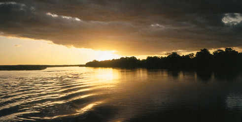
Zambia’s landscape is defined by four major river systems that play an essential role in mining, agriculture, hydroelectric power generation and biodiversity.
These include the Zambezi River, which forms much of the country’s southern border and feeds Lake Kariba; the Kafue River, which flows through the Copperbelt before joining the Zambezi; the Luangwa River, which dominates eastern Zambia; and the Luapula River, which forms a significant portion of the border with the Democratic Republic of Congo before flowing into Lake Mweru.
The country is also home to 19 national parks and numerous protected wildlife areas, reflecting Zambia’s commitment to conserving its rich natural heritage while promoting sustainable economic development.
With abundant mineral resources, a strategic geographic location, improving infrastructure and a stable investment environment, Zambia continues to strengthen its position as one of Africa’s leading destinations for mining, exploration and long-term investment.